A handful of political operatives are redrawing the state's voter boundaries right now, and the lines they approve could radically weaken or strengthen your community's political power in Congress and in the state Legislature.
The operatives compose Washington's five-member redistricting commission, which we task to redraw the maps every ten years after the census numbers come out. The commission includes two voting members picked by state Democrats, two others picked by state Republicans, and one non-voting member picked by the partisans.
Last week each of the four partisans released map proposals for state districts, and both sides have been poring over maps looking for illegal lines and egregious gerrymandering. Everybody on the commission is trying to pull some shit, but by and large Republicans are pulling the most shit.
The GOP, which has been slowly losing power in WA for a while now, attempted to draw its way into several districts under the guise of creating a more "competitive" map. Meanwhile, Democrats focused on keeping together "communities of interest," increasing the representative power of communities of color, and giving varying degrees of shit about drawing incumbents out of their own districts, all of which would probably just so happen to also shore up Democratic control in different parts of the state.
The Rules
Before we highlight some fun machinations, it's sort of helpful to know the rules that govern the process. You'll find those in RCW 44.05.090. The language of the law offers "shalls" and "shoulds." The commission must do the shalls, and it needs to have a good reason not to do the shoulds.
The must-have items include "forty-nine legislative districts" that are as "equal as practicable" in terms of population. The commission must draw those districts to create "fair and effective representation and to encourage electoral competition," and they must not "favor or discriminate against any political party or group."
As for the nice-to-have items, the commission should draw districts that are "convenient, contiguous, and compact." The district lines should also keep "local political subdivisions and areas of communities of interest" whole, and also keep counties and precincts as whole as possible.
This year, the House Dems picked Washington State Labor Council secretary treasurer April Sims to draw maps, the Senate Dems picked Grist CEO and former House Rep. Brady Walkinshaw, the House GOP picked House Rep. Paul Graves, and the Senate GOP picked Bellevue Chamber CEO and former Senator Joe Fain, who was accused of rape but denies the allegation. That group selected Sarah Augustine, the executive director of the Dispute Resolution Center of Yakima and Kittitas Counties, to serve as diplomat and negotiator between the two sides.
These people have a tremendous influence on your political power. To take one quick example from Seattle: Right now Capitol Hill lies in the 43rd Legislative District, which runs from Downtown to Madison Park and then jumps across Lake Union to scoop up Fremont and Wallingford. In Graves's proposed map, part of which I include at the top of this post, the Hill's renters would split into two different districts, with the northern one massively diluted by home-owner-heavy neighborhoods in North Seattle and the other one linked up with South Seattle.
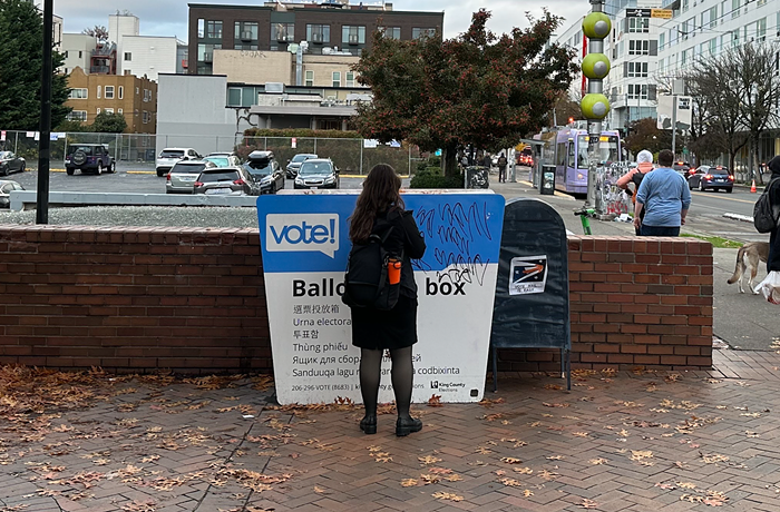
The public has until October 9 to give the proposed maps a gander and then respond at a public meeting or in writing. (Submit your comment online, at a public meeting, or via snail mail here.) After that, the commission will take your comments and their map proposals behind closed doors, work out a compromise, and then submit the final plan to Legislature by November 15. (If they can't agree, it goes to the state Supreme Court.)
The Big Fight Over "Electoral Competition" in the State Legislative District Maps
In general, the Republicans looked at their dismal electoral scoreboard, saw that the law said the commission must "encourage electoral competition," and interpreted that to mean they could run roughshod over the "shoulds" in the law in an effort to gerrymander their way to power in a blue state. In a Tweet last week, Graves said Washington currently has six so-called "swing districts." His map increases that number to 11, Fain's takes it to 8, and both Dem maps reduce it to 3.
If you overlay that 2020 statewide average over the proposed maps, here are the results. Red is R, Blue is D, Green is swing, which I define as +/- 3 points from 50/50. pic.twitter.com/GX7u69jTPT
— Paul Graves (@paulgraveswa) September 22, 2021
But the Dems argue the mandate "to encourage electoral competition" is not a mandate to encourage partisan electoral competition. The law doesn't explicitly say the commission must create more competitiveness between Republicans, Democrats, the Green Party, Socialist Alternative, or whatever.
Moreover, they argue that voters' 2004 decision to switch from a partisan primary system to a top-two system creates plenty of electoral competition. Anyone can run against anyone regardless of party in Washington races, and the results can be competitive. Just last year, for example, Democratic Sen. Mark Mullet only beat first-time candidate Ingrid Anderson by 58 votes. In the last few years, David Hackney toppled longtime House Rep. Zack Hudgins in the 11th LD, and Sen. Jesse Salomon knocked out Maralyn Chase. Republican incumbents have also fallen to challengers.
Former Stranger writer and current Civic Venture think-tanker Goldy expanded on that point in a Twitter thread, arguing that real "competition" comes from maps that encourage competitive "candidates" that suit districts, rather than maps that gerrymander districts to make one particular minority party competitive no matter how much it embraces extreme, unpopular ideas.
Unsurprisingly, Republican efforts to manifest their party's reading of the law led their operatives to draw lines that appear to flout the law's instruction to create "convenient, contiguous, and compact" districts in several cases. It also led them to break up a bunch of cities and precincts, and to disregard the representative interests of people of color in some cases. In its effort to gerrymander the map in the party's favor, the Dems believe the GOP could be running afoul of the law requiring the districts "not be drawn purposely to favor or discriminate against any political party or group."
Thing 1 could be sloppy but ultimately not really nefarious, Thing 2 is totally legal but basically nefarious, and Thing 3 is nefarious depending on your reading of the law.
The Question of Bias
In its effort to create what it believes to be more "competitive maps" it looks like the GOP map-makers obviously had to draw more districts biased toward Republicans in the blue state. One Dem analysis ran the maps through Dave's Redistricting App to determine bias and found that the GOP maps were biased toward Republicans in a lot of ways:

When it comes to displacing current incumbents, Sims was more protective than Walkinshaw, and Graves was less protective than Fain:

Looking at the Dem maps, they both try to shore up Sen. Emily Randall in the 26th, and they create more Dem districts in the Northwest by linking up the islands and changing up the lines in Whatcom County. The Republicans try to sneak in all over the state, particularly in South King County.
Sloppy but Not Really Nefarious
Because the GOP focused with laser-like precision on gerrymandering their way to victory, it looks like they flubbed some lines in a way that contravenes the law's preference for "contiguous" districts.
A "contiguous" district is one with a “common land border” and/or one that is “connected by a ferry, highway, bridge, or tunnel." And so it follows that geographical or artificial barriers that "prevent transportation within a district should not be deemed contiguous." (E.g. Even though downtown Seattle and Bainbridge Island don't share a land border, the ferry goes from downtown to the island, so a map that included both areas in one district would be deemed contiguous. That said, both areas are in different counties, so that's not great either. But I digress.)
A couple examples:


Totally Legal but Basically Nefarious
Again, the redistricting law instructs commissioners not to split up a bunch of communities, but the GOP does this more than the Dems do.
According to one Democratic analysis, Fain's map splits up more cities than any other commission member, adding more than 30 new splits to the map. He introduces 20 splits into unified cities, and 12 splits into cities that have already been split up. Fain's map also splits up a slightly higher number of counties compared to the other commissioners. The current map shows 54 total splits, and Fain increases that number to 86 splits.

Splitting up cities as Fain does weakens political power among POC in those cities:

Moreover, in the community outreach process, some tribes asked to stay split while other tribes asked to be unified in a single legislative district. Yakima wanted to be unified and the Chehalis Tribe wanted to stay split. All the commissioners unified Yakima, but only the Dems kept the Chehalis Tribe split.
That said, on that score, there's room for improvement all around. Andrew Hong, a spokesperson for Redistricting Justice for Washington (RJW), which aims for greater representation of POC in this process, said the group would like to see the commissioners draw the Muckleshoot nation into the 47th LD. "That's a community of color that’s been drawn into a very white rural district that doesn't share the same interests and priorities with the 31st LD," he said.
Over in eastern Washington, Hong praised Sims and Walkinshaw for drawing districts that have majorities of voting-age Latinos and criticized Graves and Fain for drawing districts that wouldn't have that level of representation. Though the GOP proposals would create a nominally majority Latino district in the 15th LD, it wouldn't be when considering the number of eligible Latino voters. "We believe that is a potential violation of the Voting Rights Act," Hong said, in reference to the way the GOP commissioners treated the 14th and 15th LDs.
The proposed RJW maps also created a majority POC district in Snohomish county up in the 21st LD, but none of the commissioners followed suit there.
There will be much more analysis coming in the next few days, but if you already don't like what you see here, then tell the commission about it.
In the meantime, stay tuned for the Congressional map proposals, which should be dropping shortly.